- Staircase Area and Campground
- Bear Gulch Day Use Area
- Mt. Rose Trailhead
- Dry Creek Trailhead
- Copper Creek Trailhead
For updates on the Bear Gulch Fire, visit the Olympic National Forest website at https://www.fs.usda.gov/r06/olympic and follow @olympicforest on social media.
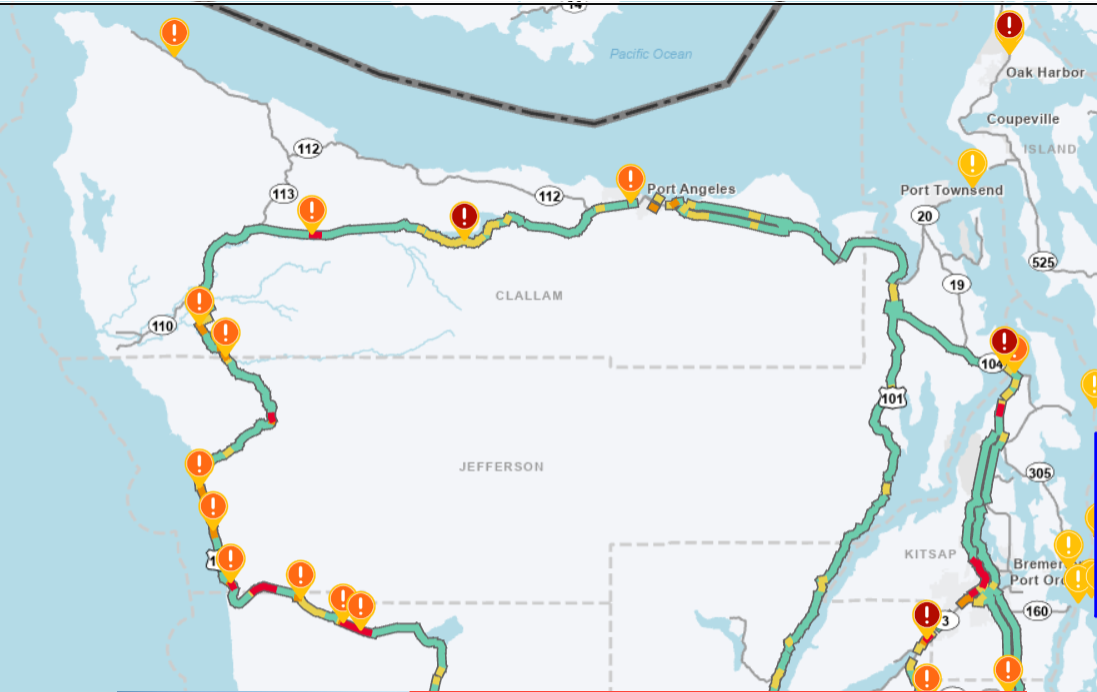
Summer is here and in western Washington that means “road construction season”. The Olympic Peninsula is dotted with orange traffic cones, flaggers, and big machinery. Please slow down, stay alert, and help keep everyone safe. We strongly recommend visitors download the WSDOT mobile app while visiting in order to stay informed on up-to-the-minute travel information, including traffic delays and ferries.
Know before you go. Find out more about Olympic Peninsula Construction and Expected Delays, and other alerts on the WA State Department of Transportation website.
HOT SPOTS
Click the links below to read more about each project.
Hurricane Ridge – Olympic National Park
Hoh Rain Forest – Olympic National Park
WA State Ferries
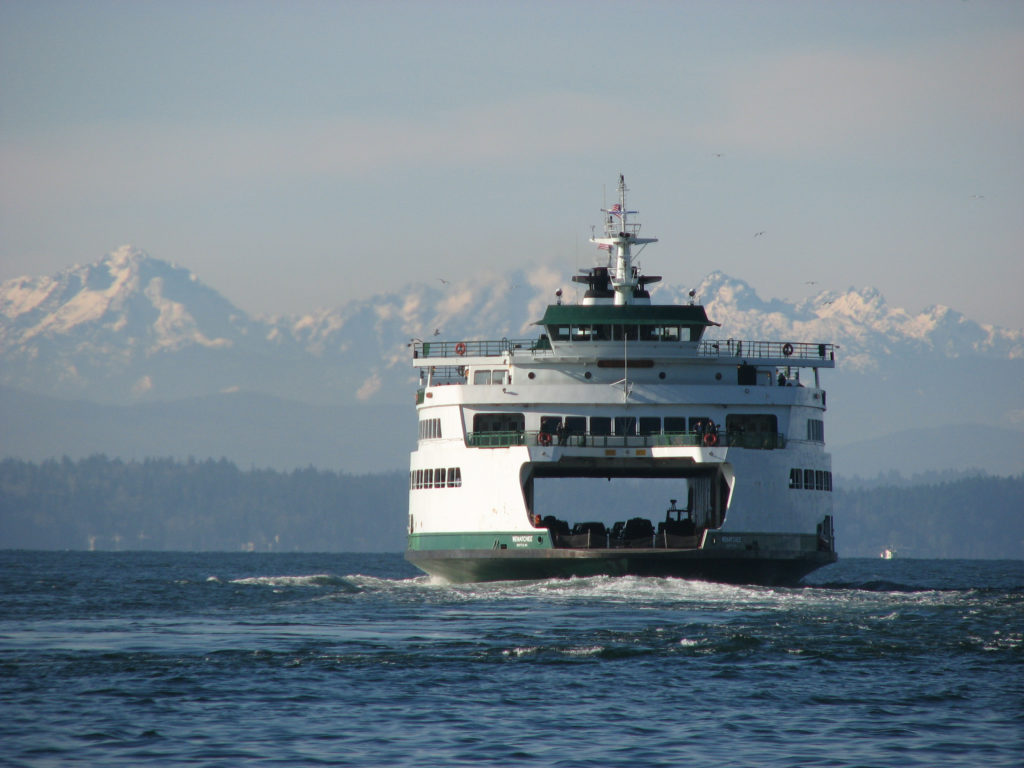
Plan accordingly. The ferries can be busy in the summer, especially on weekends and holidays. LEARN MORE
Vehicle reservations for the summer schedule (through September 20) on the Port Townsend/Coupeville route are now available to reserve.
Looking for an alternative? Here are some fun alternate routes to consider, each of which offers great things to see and do along the way (for planning purposes only; Google maps do not show real-time traffic):
Northern Route via Whidbey Island
Hood Canal Bridge (SR 104)
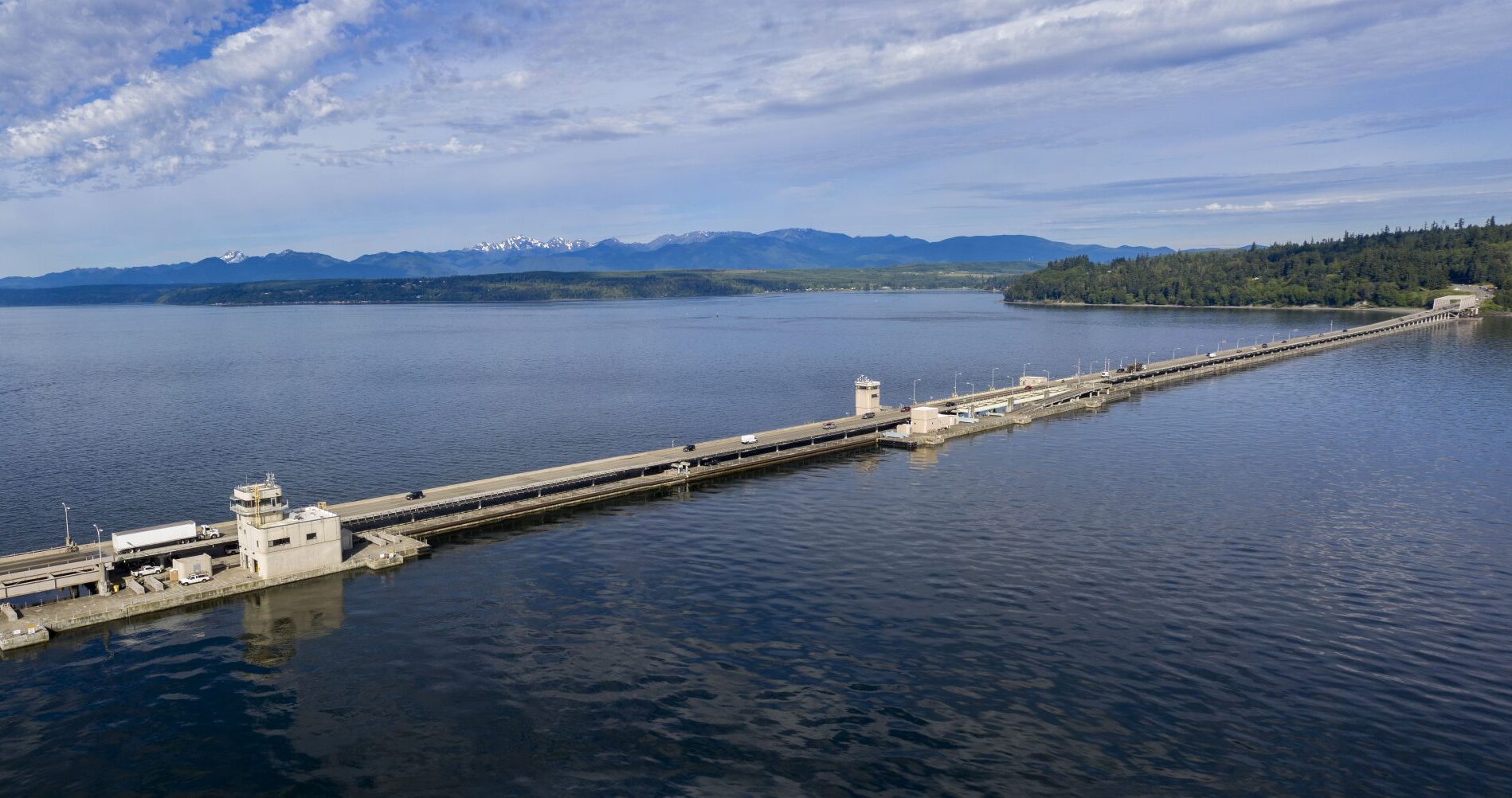
Click HERE for Hood Canal Bridge status, or download the app for real time updates. (Note that the bridge can be closed to road traffic without notice for military purposes.)
SR 104 – Jefferson County
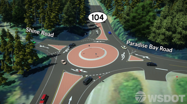
The safety improvement project on SR104 in Jefferson County, just west of the Hood Canal Bridge, is nearing completion. Final paving at the SR104/Paradise Bay Road/Shine Road intersection is scheduled for July 7 through 10, 2025. Watch for slow downs.
Click HERE for further updates.
Hurricane Ridge (Olympic National Park)
Hoh Rain Forest (Olympic National Park)

As of May 8, access to the Hoh Rain Forest via the Upper Hoh Road has been restored! The road is open, and the Hoh Rain Forest is once again open to visitors. Due to heavy visitation and limited parking at the Hoh Visitor Center, visitors should anticipate possible 1-2 hour wait times at the entrance pay station between 9am – 5pm daily. Hint: go early, or go later in the day.
Quinault Area
For information about park roads and other destinations, visitors should call the recorded Road and Weather Hotline at 360-565-3131 or visit the park website at http://www.nps.gov/olym.
WSDOT resources for safe travel
For real-time conditions & data and advanced notices for work that is planned: